LiDAR, 3D, and video tracking at production scale.
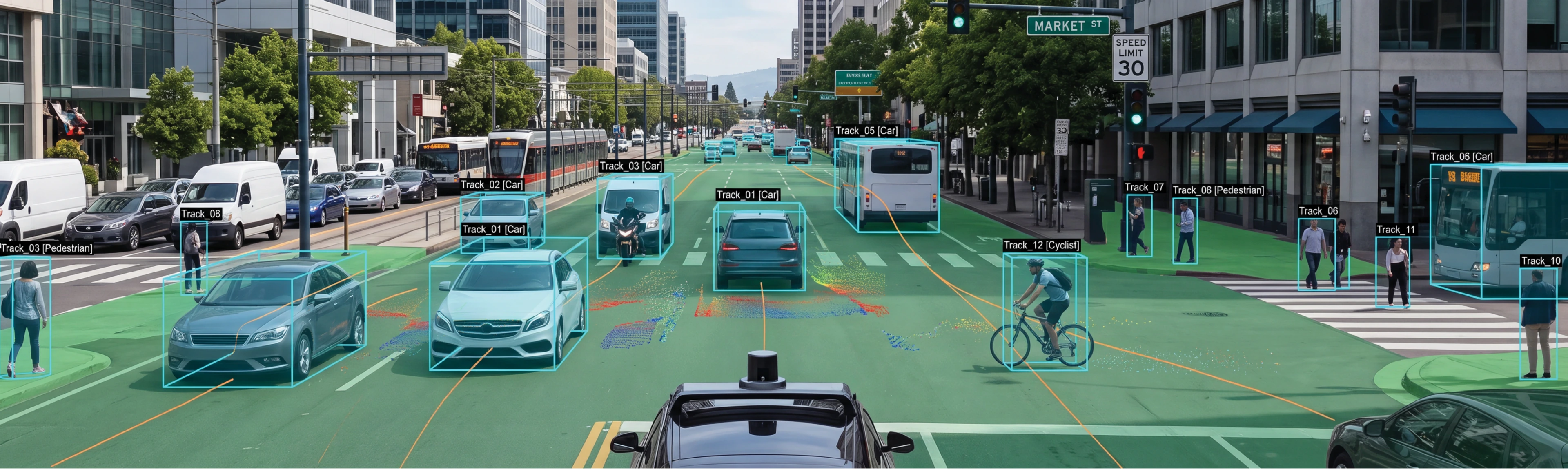
LabelFort annotates autonomous-vehicle and geospatial data, 3D cuboids on LiDAR point clouds in synchronized multi-view, video tracking with persistent identities, multimodal camera and LiDAR projects, at production scale, with KITTI and MOT17-ready exports and the per-object audit trail a safety case requires.
Perception data is safety-case data. Regulators and internal safety boards increasingly ask not just for performance metrics but for training-data provenance: who labeled the pedestrian, against which guideline, with what measured agreement.
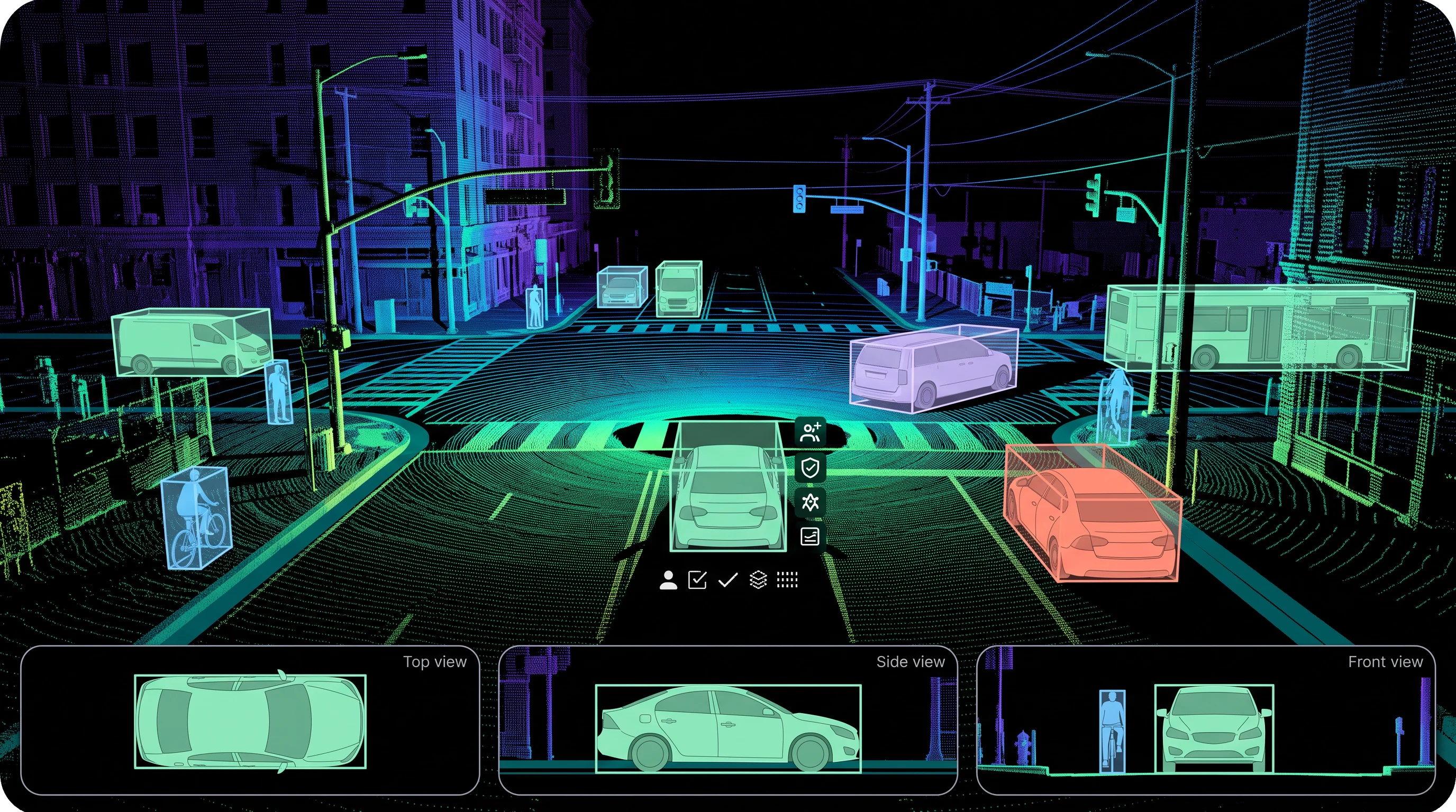
LabelFort annotates 3D cuboids in synchronized multi-view with orthographic precision editing, runs video tracking with persistent object identities and keyframe interpolation, and organizes camera and LiDAR captures in multimodal projects so scene context travels with the data. MOT17/KITTI-ready exports ship with chain-of-custody attached.
Geospatial programs, aerial imagery, satellite, drone video, run on the same stack with the residency and access controls public-sector procurement expects.
Every capture type, one safety case standard.
Placing 3D cuboids with the provenance a safety case needs
3D cuboids on LiDAR point clouds are annotated in synchronized multi-view with orthographic precision editing, so an occluded edge in one view is confirmed against the other three before a cuboid is accepted. Each cuboid carries per-object provenance, annotator and verifier identity, and the guideline version it was scored against, the record a safety case actually asks for when a regulator wants to know who labeled the pedestrian and how.
Tracking objects with an identity that survives review
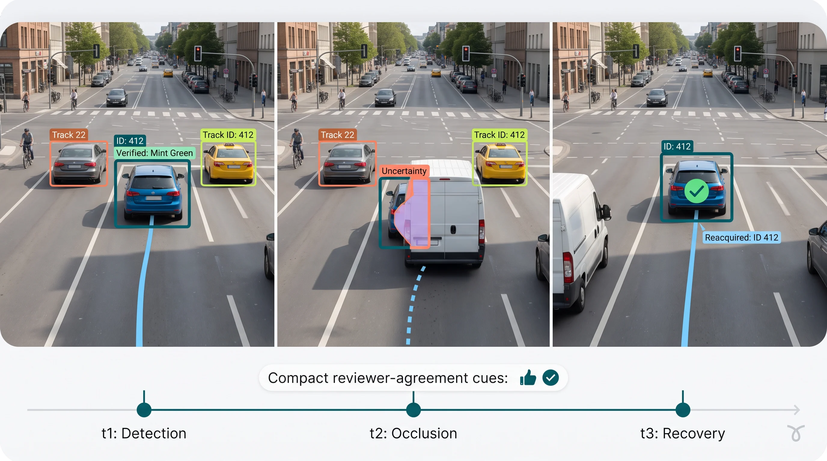
Video tracking runs with persistent object identities and keyframe interpolation, so a vehicle that passes behind another and re-emerges keeps the same ID it had before the occlusion, confirmed through cohort level agreement scoring rather than assumed automatically. MOT17 ready exports ship with the chain of custody attached, not reconstructed after the fact.
Keeping camera & LiDAR context together, not reconciled after the fact
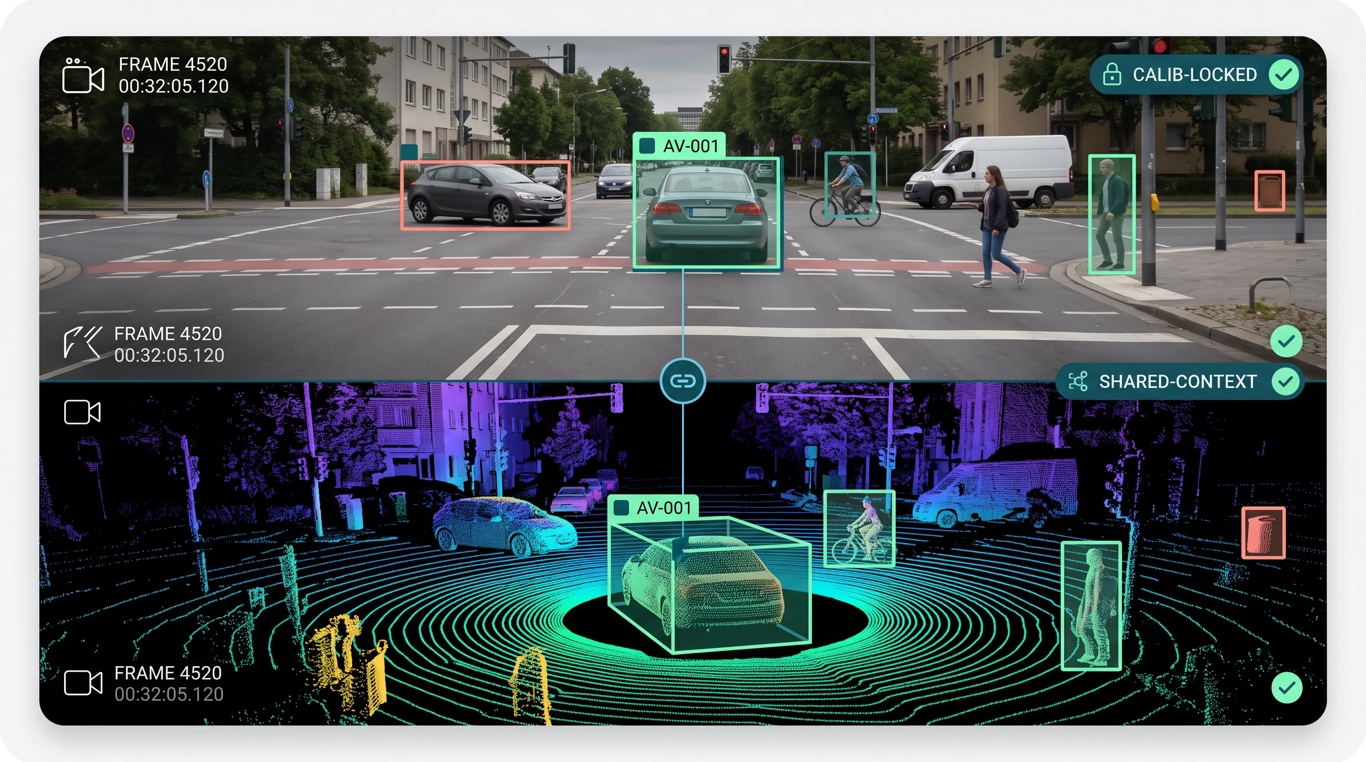
Camera and LiDAR captures are organized inside the same multimodal project, so a cuboid placed in the point cloud and its corresponding 2D box on the camera frame reference the same underlying object. Calibration between the two sensors happens before annotation starts, which means cross modal consistency is a property of the pipeline setup, not something a reviewer has to catch by eye.
Extending the same stack to geospatial & satellite programs
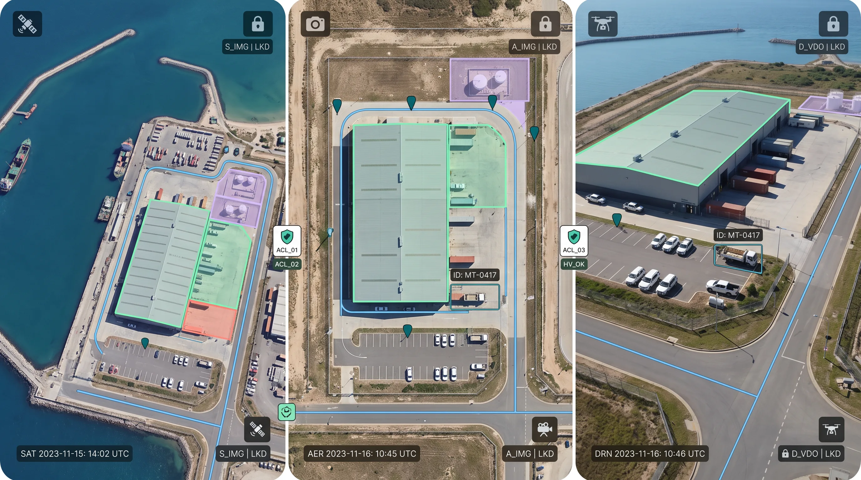
Aerial imagery, satellite captures, and drone video run on the same governed stack, with the residency and access controls public sector procurement expects built in rather than bolted on. A geospatial program doesn't need a separate vendor or a lighter evidence standard just because the source is a satellite pass instead of a vehicle sensor.
Delivering HD-map features as audit ready tabular data
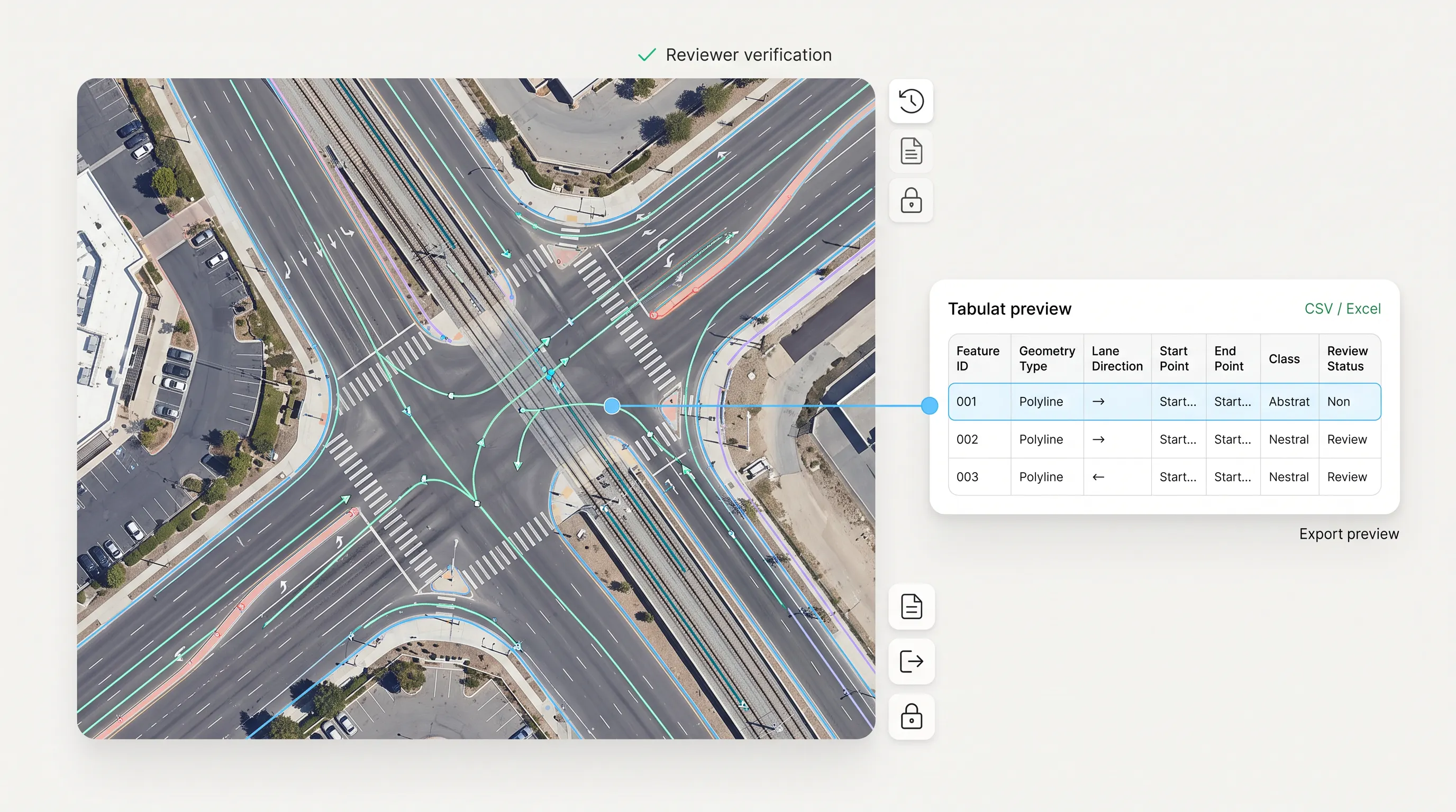
HD map features, lanes, rail corridors, utility lines, are delivered as polylines with Excel or CSV export, under the same evidence standard and audit trail as every other geometry LabelFort produces. A mapping team gets tabular data it can drop directly into a pipeline, not a format that needs reformatting before it's usable.
FAQs
What export formats does LabelFort support, and what audit evidence ships with each dataset?
We support KITTI for driving scenes with 2D and 3D cuboids, MOT17 for tracking, and COCO for camera frames. Exports are available in Excel or CSV with full attribute fidelity. Each dataset includes per-object provenance, annotator and verifier details, guideline version, and model seed, providing a verifiable training data trail for safety documentation.
Ready to evaluate LabelFort against your regulator's checklist?
Begin with our one-hour Compliance Review to see how our lidar & point cloud annotation align with your regulatory checklist. We will scope an evidence-grade proof of concept using your data & requirements. We do not offer open trials or engage in pricing games.
Certifications & readiness